Latest Articles
Articles in press have been peer-reviewed and accepted, which are not yet assigned to volumes/issues, but are citable by Digital Object Identifier (DOI).
Display Method:
, Available online , doi: 10.12403/j.1001-1498.20230450
 [Abstract]
 [FullText HTML]
 [PDF 3373KB]
Abstract:
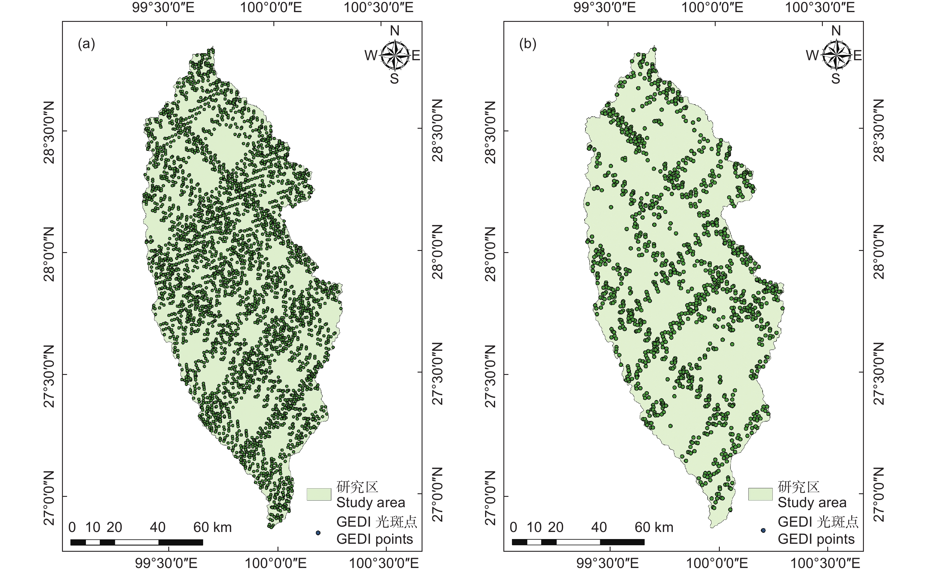
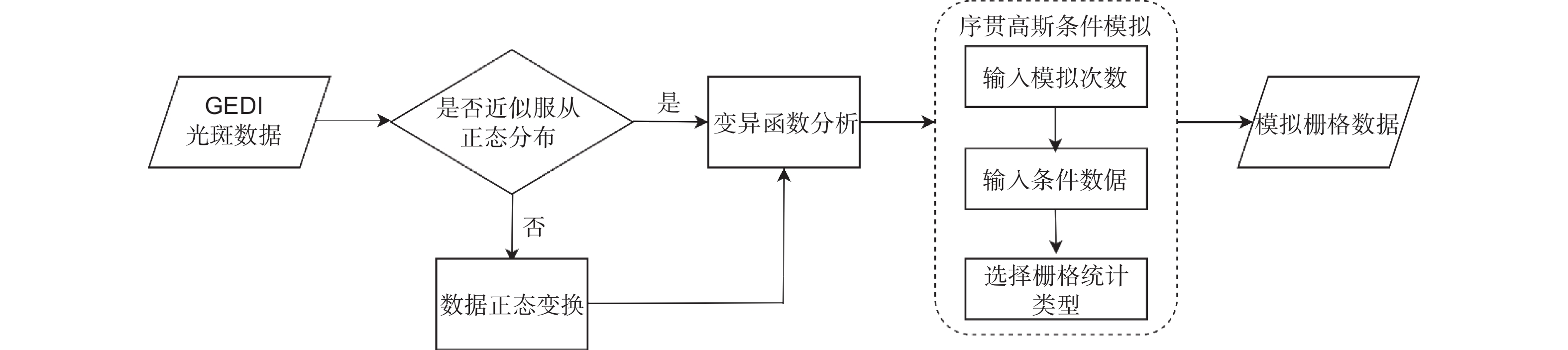
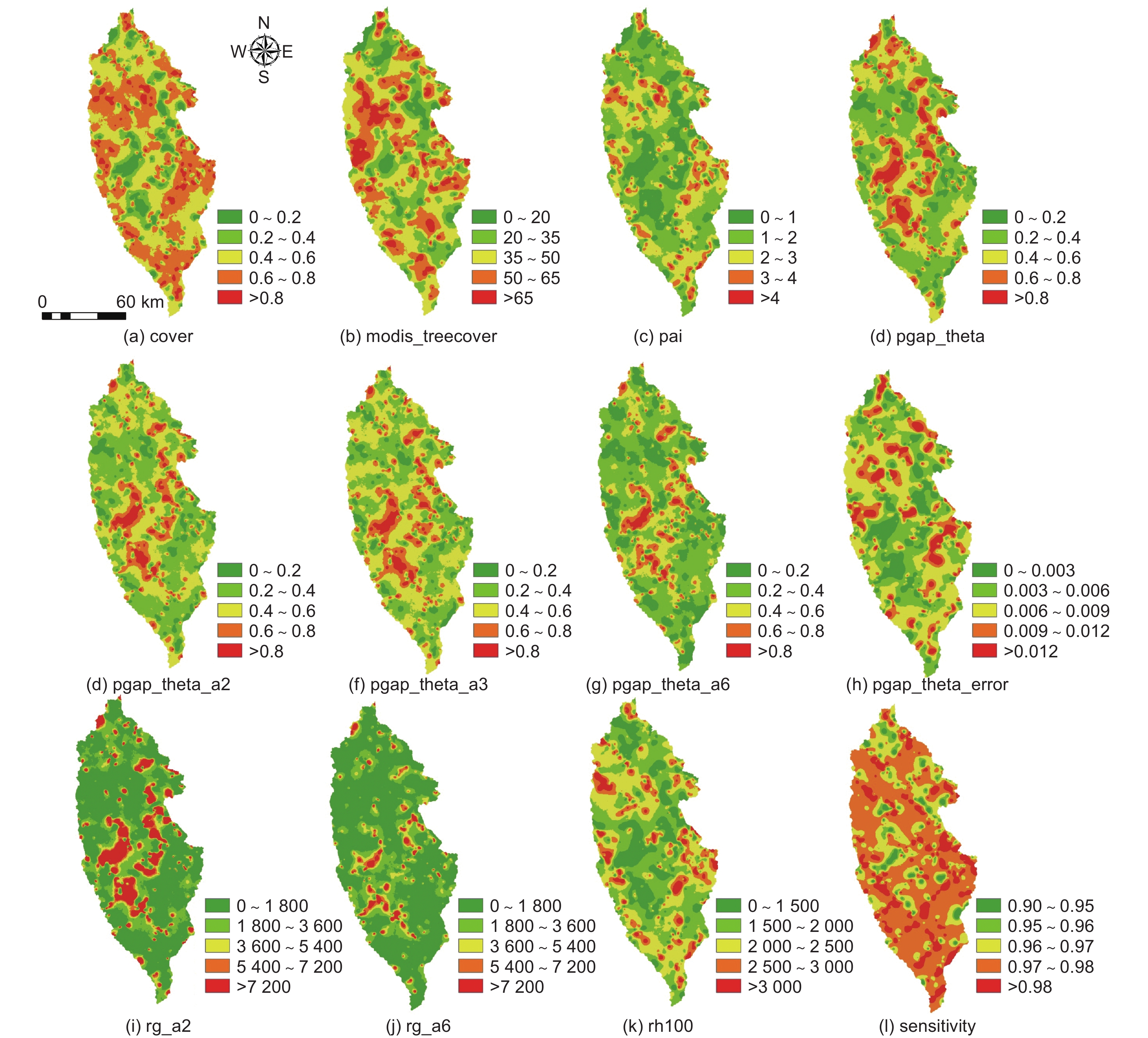
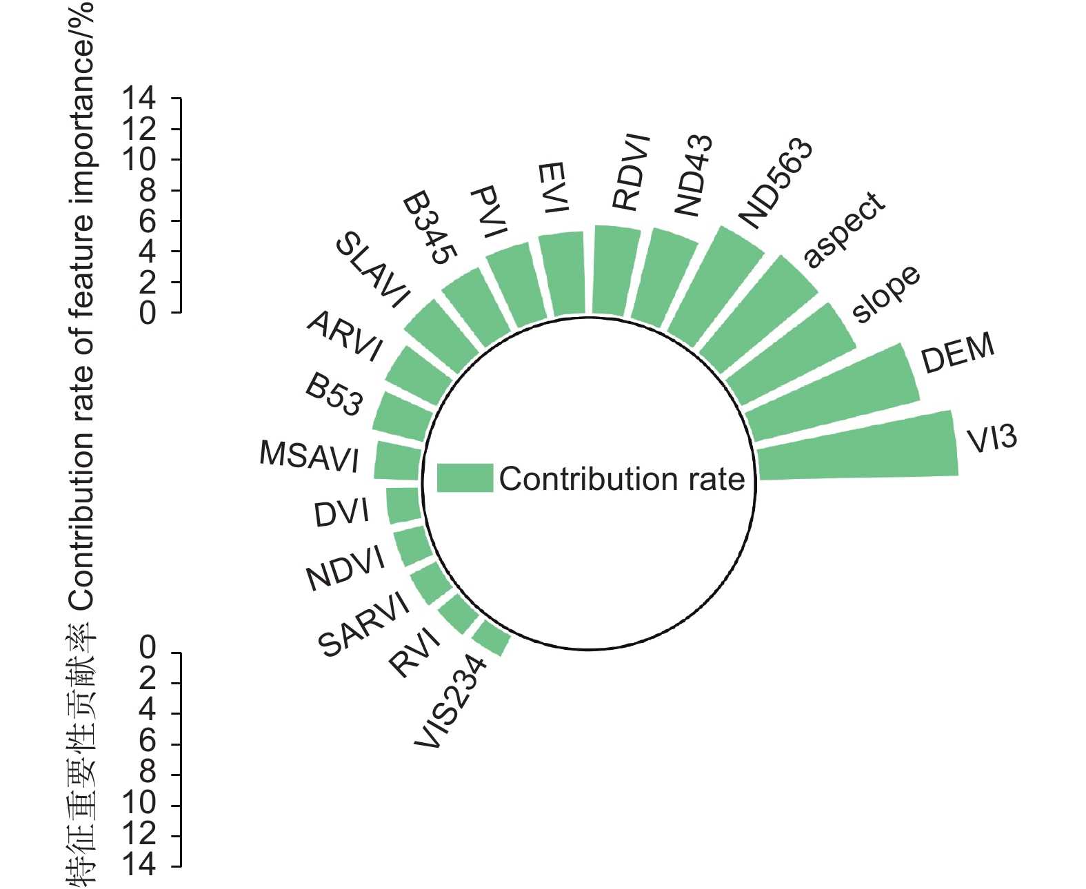
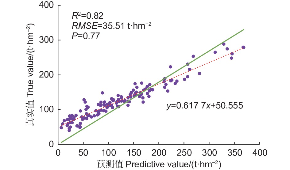
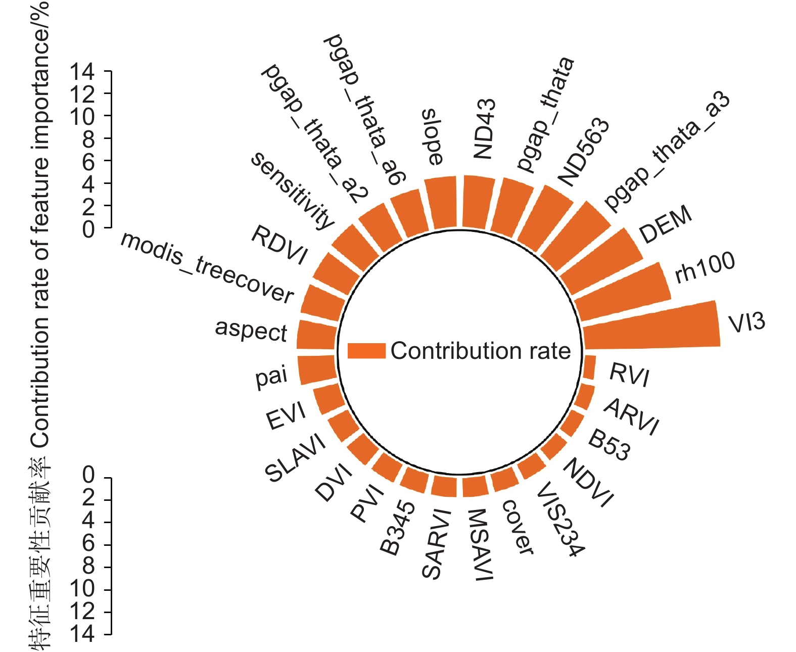
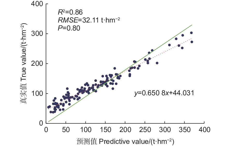
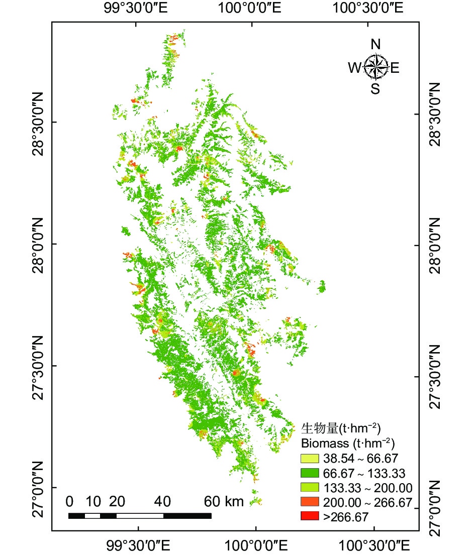
Objective There are significant limitations in estimating forest biomass using a single remote sensing technology. The research aims to utilize the advantages of multi-source remote sensing collaboration technology to complement LiDAR and optical remote sensing, and to improve the accuracy of biomass estimation. Methods Based on the two main information sources, including spaceborne LiDAR GEDI and optical remote sensing Landsat8 data, Sequential Gaussian Conditional Simulation (SGCS) method was used to achieve spatial expansion of GEDI data from "points" to " polygons". Combing with aboveground biomass data of 138 plots, the random forest method was used to estimate the aboveground biomass of Picea asperata and Abies fabri forests in Shangri-La, Yunnan Province. Result (1) The SGCS method was used to perform spatial interpolation on GEDI footprints, and the simulated spatial distribution maps of 12 biophysical indicators showed random and fragmented characteristics, which were very similar to the spatial distribution and clustering of forests, and the OEC of 9 indexes involved in modeling were greater than 0.90. (2) The accuracy of the random forest model constructed using a single optical remote sensing Landsat8 data was: R2=0.82, RMSE=35.51 t·hm−2, P=0.77; The accuracy of the random forest model constructed by combining two types of remote sensing data was: R2=0.86, RMSE=32.11 t·hm−2, P=0.80. It could be obviously found that the accuracy of the model was improved. (3) The total aboveground biomass of Picea asperata and Abies fabri forests in Shangri-La in 2019 estimated by multi-source remote sensing technology was 37 042 605.68 t, and the average biomass was 123.28 t·hm−2. Conclusion The SGCS method based on geostatistics has some advantages, including considering the spatial heterogeneity of the research object and being able to overcome smoothingeffects I is feasible to achieve spatial expansion of GEDI footprints from "point" to " polygon ". The multi-source remote sensing data based on the combination of spaceborne LiDAR GEDI and optical remote sensing Landsat8 can effectively fill the defects of a single remote sensing data source, improve the estimation accuracy of forest biomass, and provide a reference for the combination of LiDAR and optical remote sensing to estimate large-scale and fully covered forest biomass.


 Subvmission Guidelines
 Peer Review
 Reviewer Online
 Office Work


 Email alert
 RSS
RSS